VaxMap 2.0: West Health Policy Center and University of Pittsburgh School of Pharmacy Develop County-Level Map of Potential COVID-19 Vaccine Locations

Tool exposes potential locations and populations with limited access to facilities to administer COVID-19 vaccines
As state and local authorities design their vaccine distribution and administrations plan, West Health and the University of Pittsburgh School of Pharmacy have developed a series of maps displaying potential COVID-19 vaccine administration facilities across the country. The maps identify areas and populations with lower access to existing health care facilities to administer the vaccine. This first map is broken into five county-wide analyses, the map displays how many facilities there are to administer the vaccine per 10,000 residents, as well as identifies how many residents live within a 10-mile radius of a vaccination facility, with particular attention to how far seniors live from a given facility. Additionally, risk scores are assigned to each county. The second map features an interactive tool to display the location of each potential vaccine administration point down to the street level. These interactive visualizations can serve as tools to aid state and local authorities in the development of COVID-19 vaccine distribution and administration plans.
West Health and the University of Pittsburgh School of Pharmacy have developed a map of potential COVID-19 vaccine locations in the United States
 VaxMap is a detailed and highly interactive tool. We recommend visiting this page on a desktop or laptop computer for the best experience.
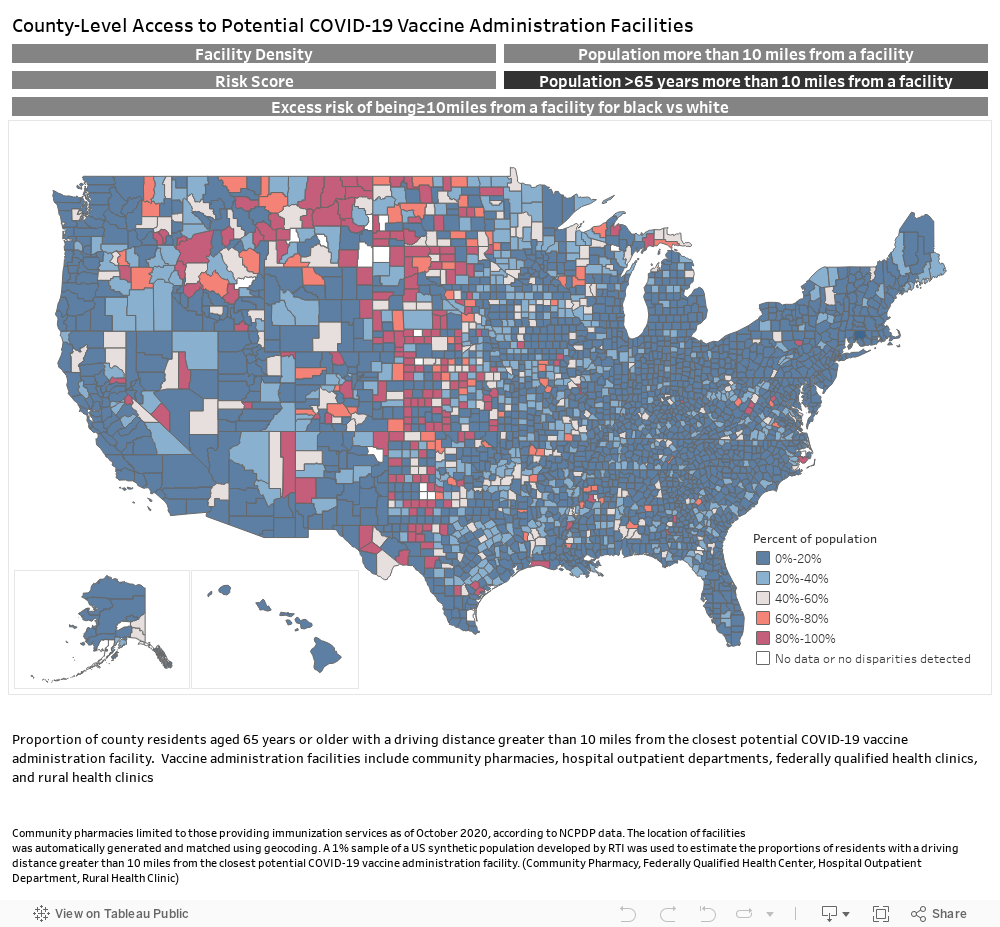
 VaxMap is a detailed and highly interactive tool. We recommend visiting this page on a desktop or laptop computer for the best experience.